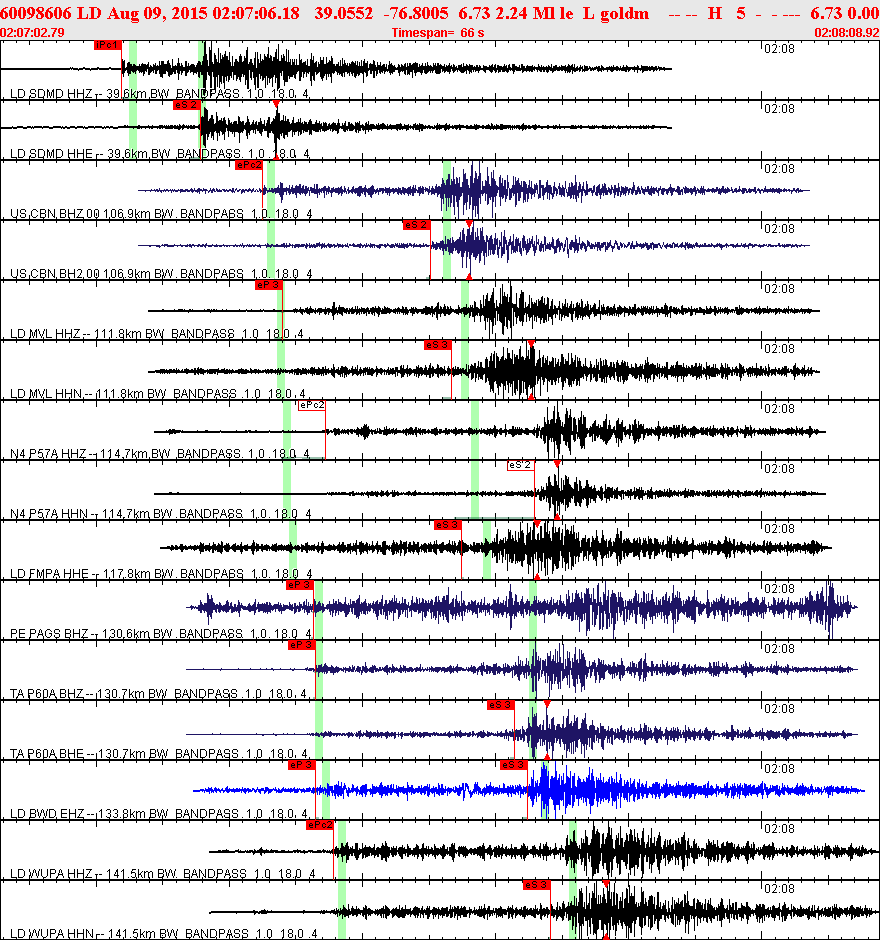
Event Type:
Earthquake
Region:
19 km SW of Glen Burnie, MD
Date-Time:
8/09/2015 02:07:06.18 (UTC)
Date-Time:
8/08/2015 22:07:06.18 (EDT)
Magnitude:
2.24 Ml
Latitude:
39.055 N
Longitude:
76.801 W
Depth:
6.73 km
Epicenter Map
A Community Internet Intensity Map
Felt reports by residents via the Internet
Seismic records from some selected stations
Bulletin (Phase data)
Waveform (seed volume)
Click to download the file
(may need to hold shift key)
Click to download the file
(direct path)