Event Type:
Earthquake
Region:
7.6 km W of Concord, NH
Date-Time:
8/29/2015 21:50:34.76 (UTC)
Date-Time:
8/29/2015 17:50:34.76 (EDT)
Magnitude:
1.3 Ml
Latitude:
43.221 N
Longitude:
71.63 W
Depth:
4.3 km
Epicenter Map
A Community Internet Intensity Map
Felt reports by residents via the Internet
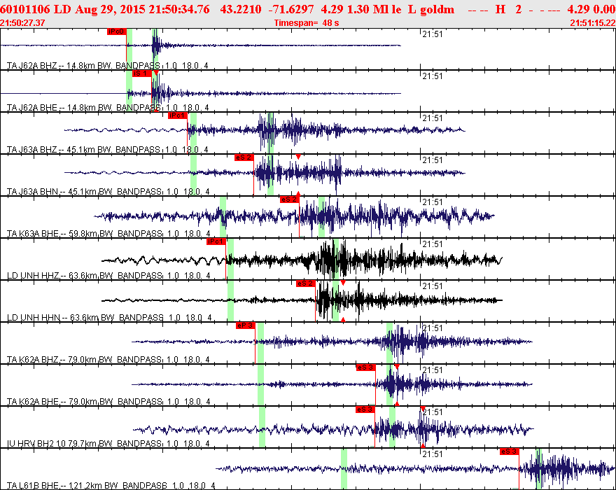
Seismic records from some selected stations
Bulletin (Phase data)
Waveform data (concatenated MiniSeed files)
Click to download the file
(may need to hold shift key)